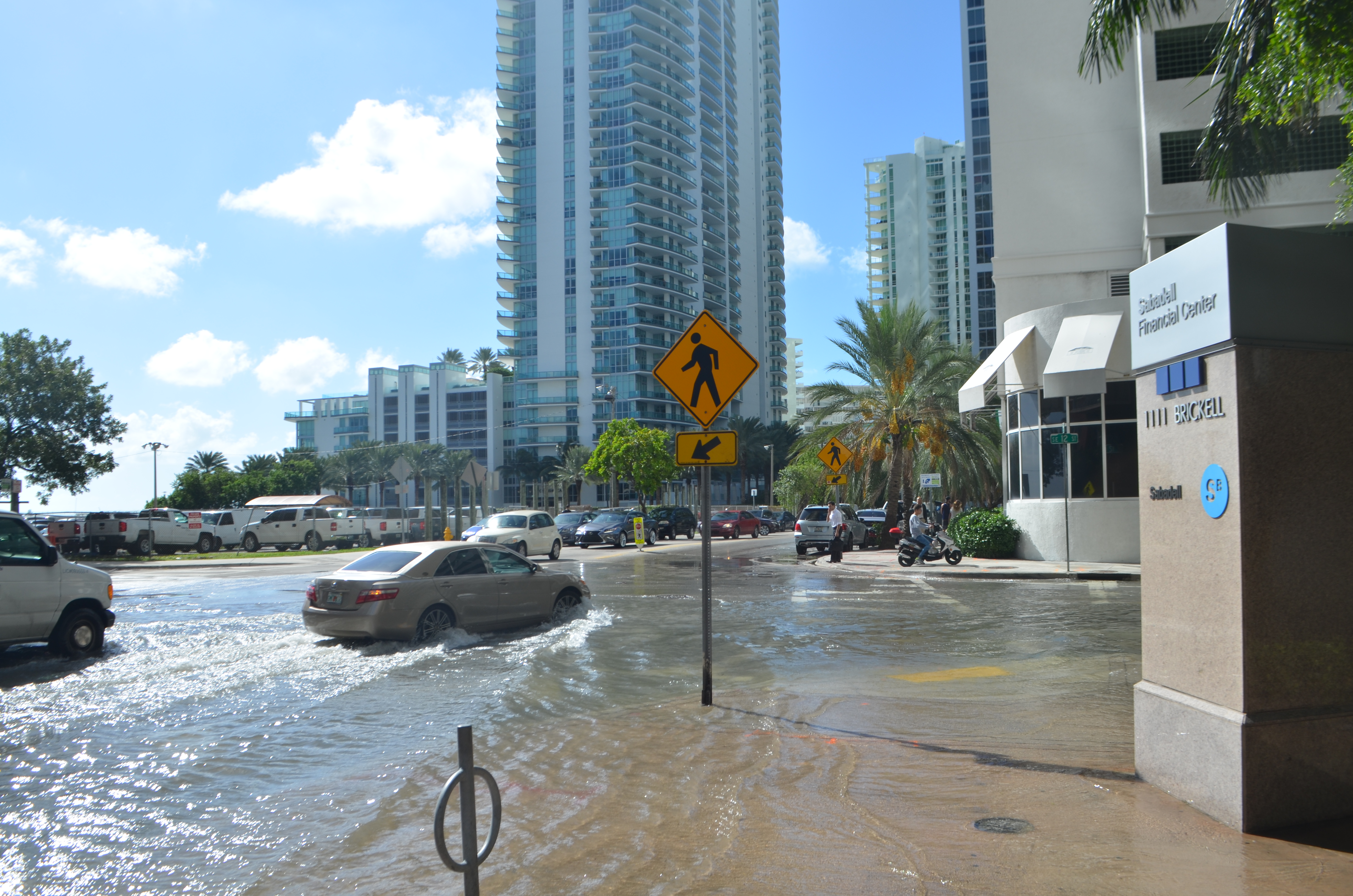
Miami's Virginia Key tidal gauge recorded its worst king tide ever the week of Oct. 26, with water levels matching those of past hurricanes.
The record, first reported by the Miami Herald, registered about 2.5 feet of water above high tide at the gauge near Key Biscayne. The National Weather Service classifies that as "major" flooding. Only Hurricane Irma in 2017, which brought 3.6 feet above high tide, has pushed more water through the gauge since it was installed in 1994.
Brian McNoldy, a senior research associate at the University of Miami's Rosenstiel School of Marine and Atmospheric Research, told the Herald that Hurricane Wilma in 2005, Hurricane Irene in 1999 and the late-October king tide were "basically a 3-way tie." No storm was on the horizon when the record fell.
That single week was part of a broader pattern. So far in 2026, Miami has logged 15 days of serious flooding at the Virginia Key gauge, the Herald reported Nov. 5. The previous annual high was nine days. Two more rounds of king tides are expected before year's end.
Of the top 14 highest tides recorded at the Virginia Key gauge, 10 were caused by king tides rather than storms, the Herald found. Eight of those 10 occurred in the last two years.
Why it's getting worse
Sea level rise is one driver. South Florida has seen about 5 inches of rise since 2005 and about 8 inches since the gauge went in, according to the Herald's reporting. But the moon's 18-year orbit cycle is compounding the problem. The region is entering a phase of that cycle where the moon sits closer to Earth and pushes tides higher. Scientists told the Herald that high tides could run as much as half a foot higher in the next few years.
Jeff Masters, a meteorologist and former hurricane hunter in Miami, told the Herald the record tides of late October will seem ordinary by the 2030s.
Under NASA's intermediate-high sea level rise projections, Miami could see 24 days of flooding a year by 2035 and 75 days a year by 2045, the Herald reported.
What Key Biscayne is doing
The village is a low-lying barrier island without a coastal ridge, according to its own resiliency planning documents. Dunes offer some natural protection on the ocean side, but development has encroached into the back dunes while wave action has shrunk the beach.
Key Biscayne's Resilient Infrastructure and Adaptation Program (RIAP) targets five areas: shoreline protection, stormwater upgrades, roadway improvements, utility hardening and regulatory modernization, according to a September 2024 village presentation. The village describes its stormwater system as "aged, disconnected and ineffective."
Zone 1, the low-lying area around the K-8 Center, is the top priority. The projected cost for that zone alone is about $74.9 million, covering stormwater, roadway, utility and design work. The village estimates every $1 invested would prevent roughly $5.46 in flood damage. Without the program, 461 structures would be affected; with it, that number drops to 50.
In April, the Village Council unanimously approved an injection-well stormwater plan from GIT Consulting for Zone 1, the Islander News reported. Construction was scheduled to begin in January 2026 and run through September 2028, per the village's project timeline.
Separately, an evaluation committee recommended Moffatt & Nichol Inc. for the village's Offshore Feasibility and Preliminary Shoreline Design Study in August, according to village procurement records. That recommendation was forwarded to the Village Manager and Council. The U.S. Army Corps of Engineers is also conducting a coastal storm risk management feasibility study for the island, with a chief's report expected in July 2028.
The next round of king tides is expected the week of Thanksgiving.